Photo:
Wegge, Bjørn
/
Anno Musea i Nord-Østerdalen
(In Copyright)
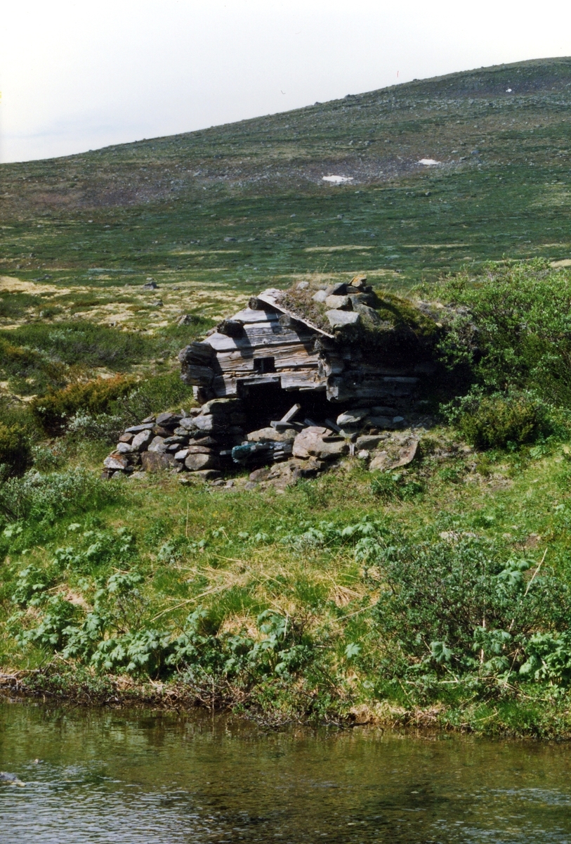
Burest ved Kvittjønnan
Kartref.: 39550.05226 (GPS) (1519 I)
Beliggenhet: Omtrent 40 meter NNØ for 2122. På motsatt side av en liten haug og inne i en liten vik, omtrent 2 meter fra vannkanten. Buresten l ...
Kartref.: 39550.05226 (GPS) (1519 I)
Beliggenhet: Omtrent 40 meter NNØ for 2122. På motsatt side av en liten haug og inne i en liten vik, omtrent 2 meter fra vannkanten. Buresten ligger altså på nordsiden og omtrent 100 meter fra utløpsoset til 1. vatnet, regnet langs vannkanten.
Bruk: Dette har trolig vært en gammel jakt- og fiskebu, muligens også brukt som naust.
Byggemateriale: Steinbu, dels muret inn i bakken.
Forfatning: Bare de murete steinveggene står tilbake.
Mål: 4,0 x 2,5 meter. De murete steinveggene er ca 0,5 meter tykke. Åpning mot vatnet.
Annet: Ola P. Slåsæther fortalte den 3/2 1999 at dette er restene etter det opprinnelige naustet til fiskebua 2122. Jeg er ikke så sikker på det. Mye tyder på at dette har vært en regulær over-nattingsbu, bl.a. finner jeg rester ettter et ildsted. Åpningen på bua (1,3 meter) tyder heller ikke på at dette har vært et naust.
Grete og jeg undersøkte denne buresten den 4. juli 1999.


Add a comment or suggest edits
To publish a public comment on the object, select «Leave a comment». To send an inquiry directly to the museum, select «Send an inquiry».