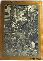
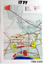
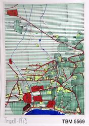
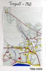
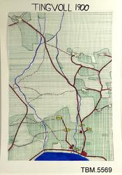
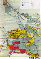
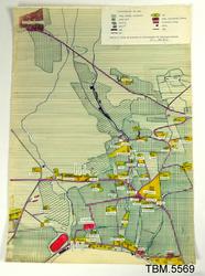
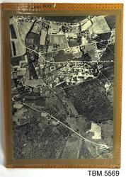
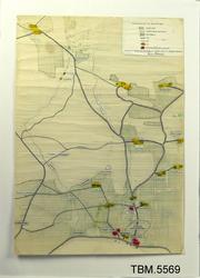
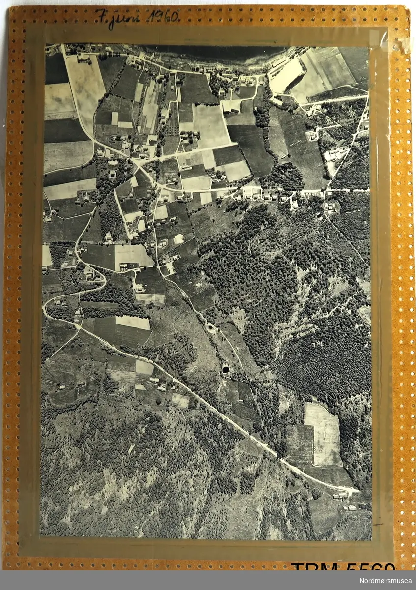
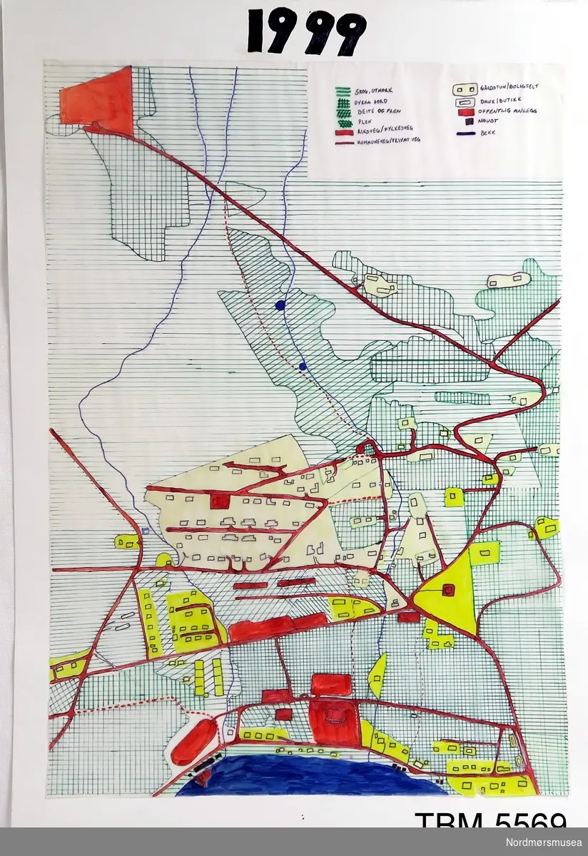
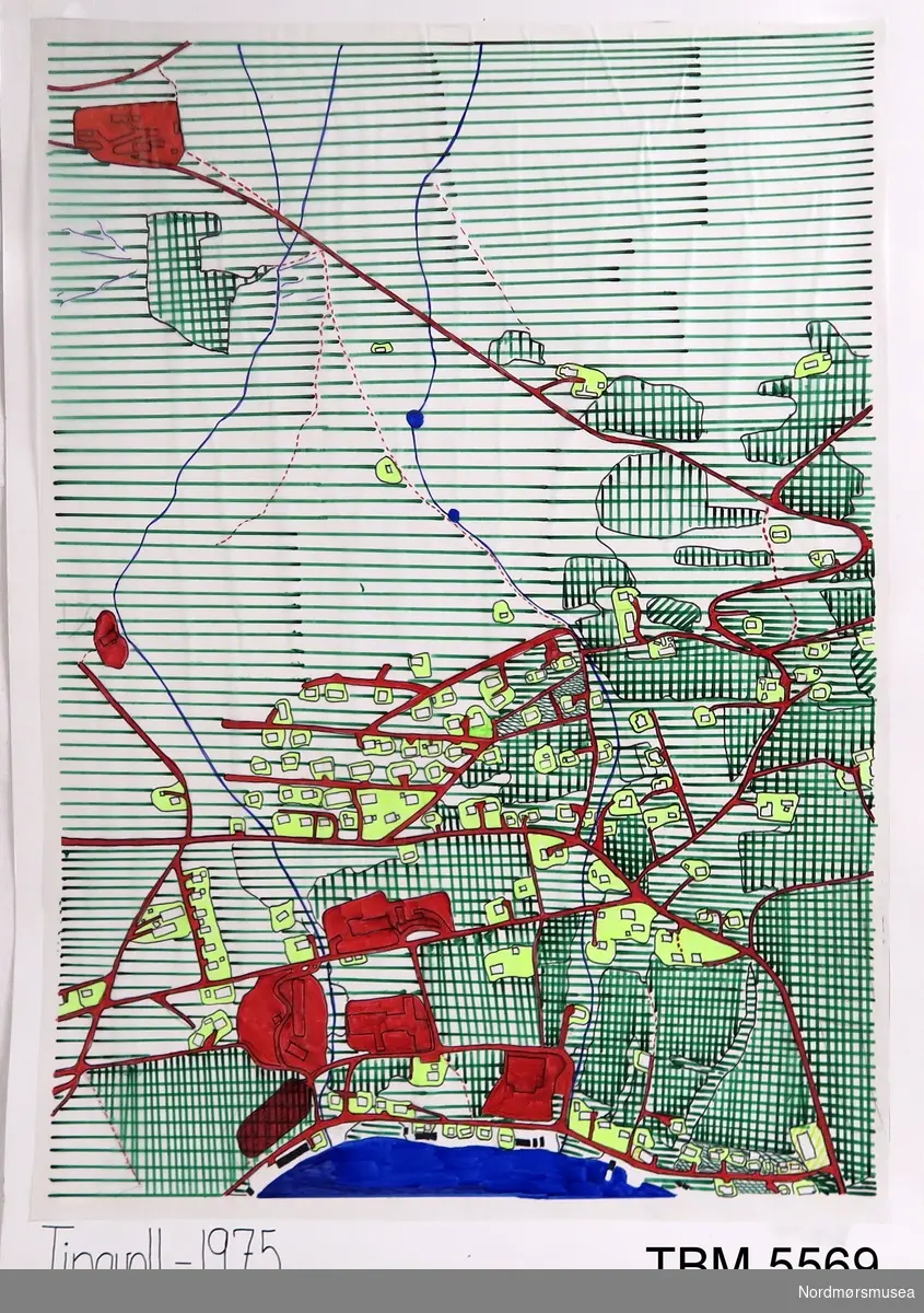
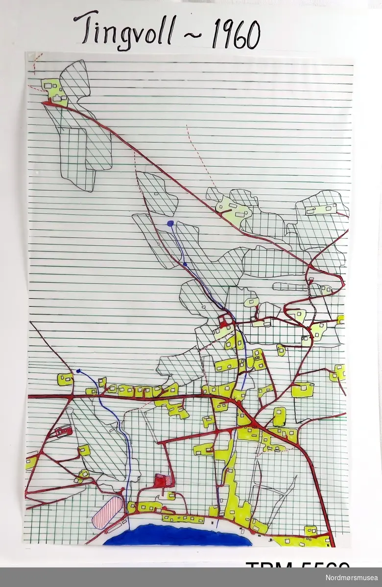
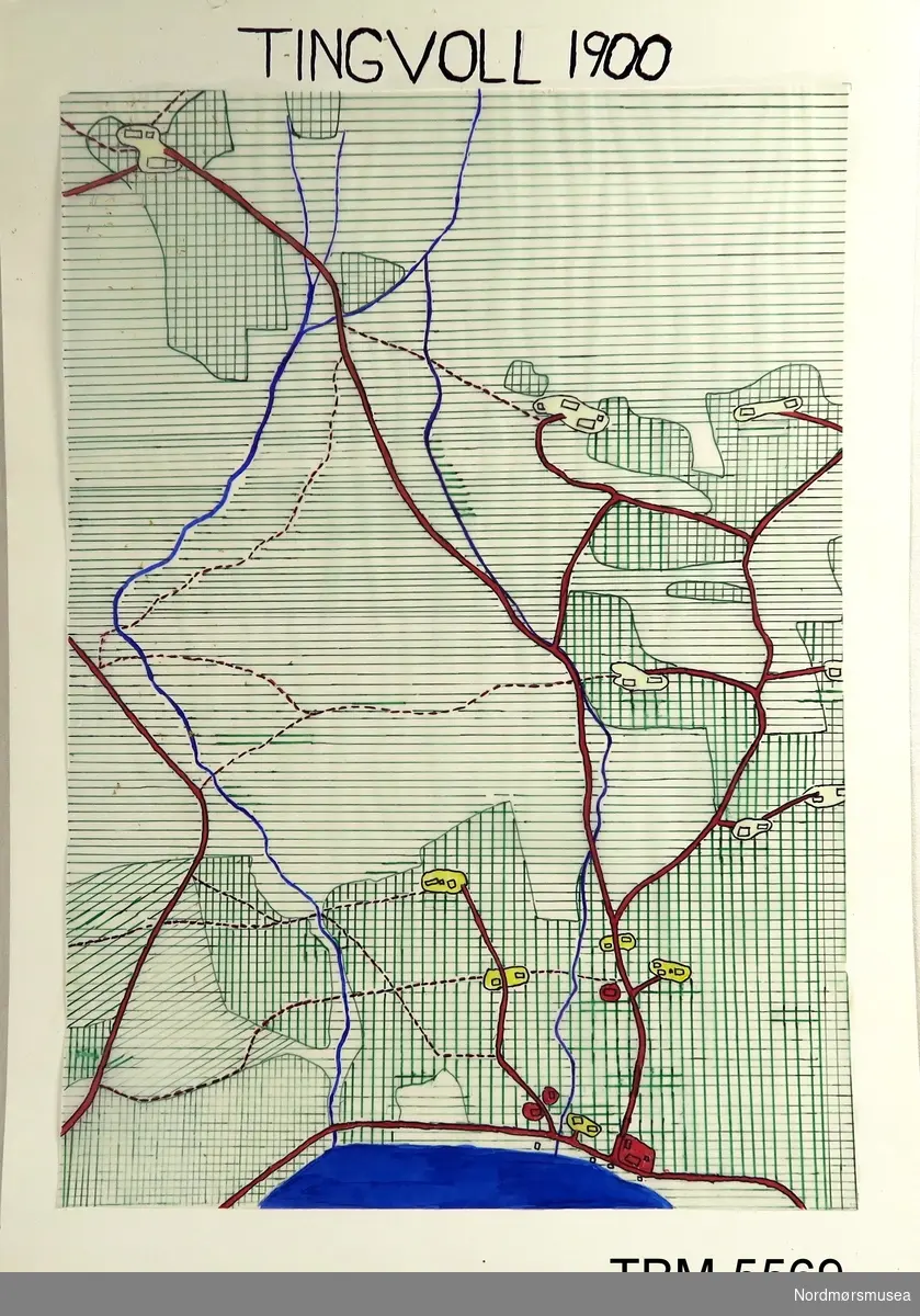
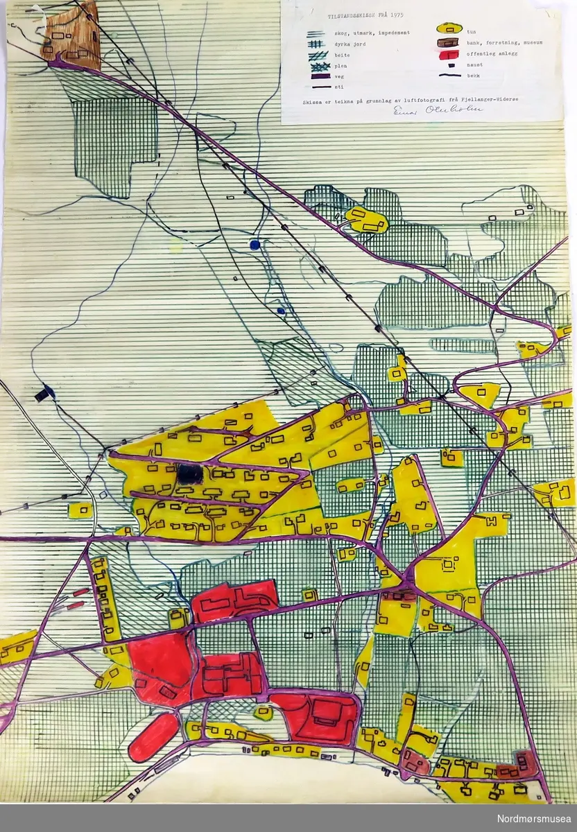
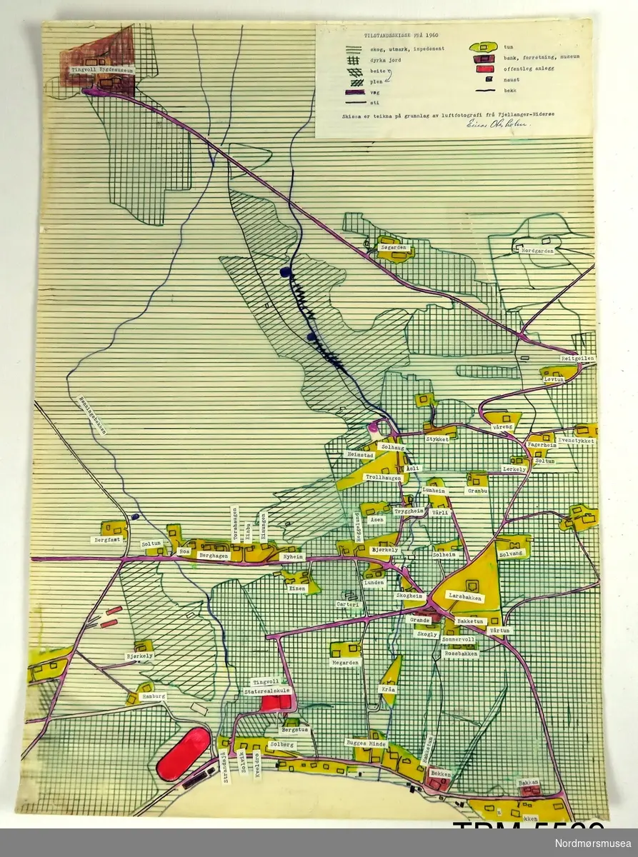
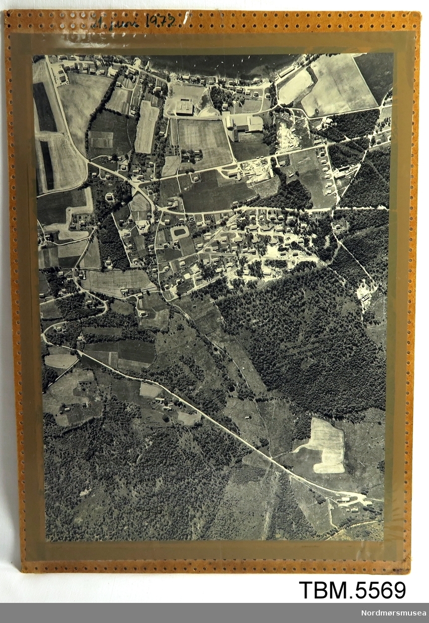
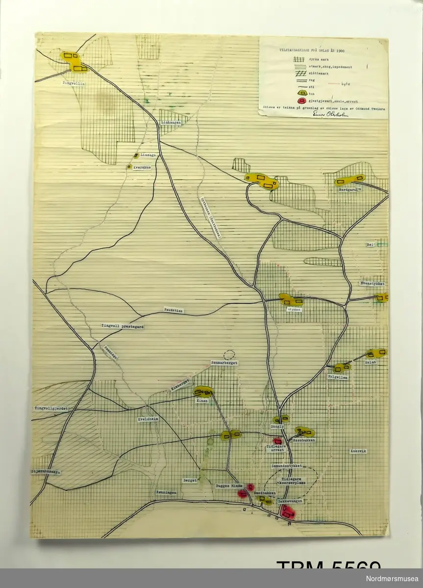
Photo: Nordmørsmusea Photo: Nordmørsmusea Photo: Nordmørsmusea Photo: Nordmørsmusea Photo: Nordmørsmusea Photo: Nordmørsmusea Photo: Nordmørsmusea Photo: Nordmørsmusea Photo: Nordmørsmusea Tingvollvågen 1900-1999 icon--add Add to folder icon--add Add to folder Remove from folder Order images 0 Comment/inquiry social--facebook social--more Share About the object aboutHandteikna kart og flyfoto over området. Viser utviklinga, husbygging og utnyttinga av landskapet, i tida 1900 til 1999. 1900-1960-1975-1999 teikningar. 1990-1972 flyfoto. DesignationTingvollvågen 1900-1999 Precise designationUtviklinga frå sjøen til Tingvollia IdentifierTBM.5569 Indexing termUndervisningsmateriell Type Thing Dimensions value Breddeca50.0 cmHøyde70.0 cm MaterialsPapir Glas TechniquesTeikningar/Skrift Fotografi Created with Sketch. Add a comment or suggest edits History Bilde og kart som viser utviklinga i området på nordsida av Tingvollvågen frå sjøen oppover Reitgrenda til Tingvollia. Ei prosjektoppgåve som Einar Oterholm og elevane hans skreiv.BrukProduksjon: 1999 (Sannsynleg)Aksesjon: 1983 (Sannsynleg) Expand text Collapse text Created with Sketch. Add a comment or suggest edits Classification Geografisk beliggenhet (Outline)OU 131Tettsted, bebyggelse (Outline - Bebyggelsesmønster)OU 361.5Høyere undervisning (Outline)OU 873 License information License Contact owner for more information Metadata IdentifierTBM.5569 Part of collectionNordmøre museum Owner of collectionMøre og Romsdal InstitutionNordmørsmusea Date publishedMarch 22, 2017 Date updatedSeptember 20, 2023 DIMU-CODE021026949607 UUIDedbea3d1-a318-46fd-9fc6-12fdf5e53b6d Tags For adding tags, log in. There are 57 results for «Undervisningsmateriell» in Nordmørsmusea: Tingvollvågen 1900-1999. Handteikna kart og flyfoto over området.... Bibelhistoriske plansjer. Fargelagte bilete til bruk i kristendom... Bibelske Billeder fra Mallings Boghandel. Bileta er i svart kvitt... Kamera i metall med glassplate og linse. Var nok brukt til underv... Skolemateriell. Geografia har eit slyngemønster på framsida og ei... View more Add a comment or suggest edits To publish a public comment on the object, select «Leave a comment». To send an inquiry directly to the museum, select «Send an inquiry». Leave a comment or send an inquiry You are not logged in – Log in You are not logged in – Log in Your name Your email Add comment or cancel Send an inquiry Your message will be sent to Nordmørsmusea. Recipient Message You are not logged in – Log in Your name Your email Send email or cancel New comment or inquiry


Add a comment or suggest edits
To publish a public comment on the object, select «Leave a comment». To send an inquiry directly to the museum, select «Send an inquiry».