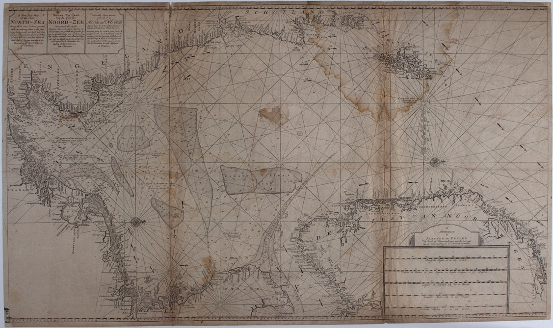
A new sea map of the whole North Sea. Showing all the rivers, harbours, grounds, depths and anchoring-places in the same.
About the object
about
Engelsk kart over hele Nordsjøen. Kartene beskrives også på hollandsk og fransk. A new sea map of the whole North Sea. Showing all the rivers, harbours, grounds, depths and anchoring-places in the same. Being some grounds and depths laid down according to the experience of several fishers of Mase-land-sluce and from Texel to the... Engelsk kart over hele Nordsjøen. Kartene beskrives også på hollandsk og fransk. A new sea map of the whole North Sea. Showing all the rivers, harbours, grounds, depths and anchoring-places in the same. Being some grounds and depths laid down according to the experience of several fishers of Mase-land-sluce and from Texel to the south coast of Norway according to the observations of capt. J. Heyteman of Christiania. Johannes van Keulen, Amsterdam ca. 1688.
Info i protokoll: A new sea map of the whole North Sea. Showing all the rivers, harbours, grounds, depths and anchoring-places in the same: Being some grounds and depths laid down according to the experience of several fishers of Mase-land-sluce and from Texel to the south coast of Norway according to the observations of capt. J. Heyteman of Christiania.


Add a comment or suggest edits
To publish a public comment on the object, select «Leave a comment». To send an inquiry directly to the museum, select «Send an inquiry».