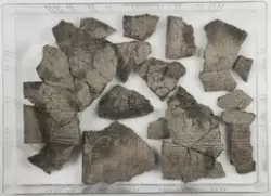
Arkeologisk registrering utført i forbindelse med reguleringsplan for utvidelse av E6 gjennom Rygge kommune i tidsrommet 02.10.–03.11.2000, og utgravning i 29.04.–.24.05.2002. Konsekvensutredet av ENCO A/S i 1999. Ved registreringer ble det påvist 18 lokaliteter, og 14 av disse er undersøkt. Traseen er omtrent 8,4 km lang og følger i hovedsak nordøstre ytterkant av Raet. Den går som et ca 100 meter bredt belte gjennom dyrket mark, løv- og barskog. Funnene har fått C53105–C53121. Lok. A (Narmos Lok. 3). Lokaliteten ligger i dyrket mark, med begrenset utsikt da den ligger forholdsvislavt i terrenget. Terrenget stiger svakt mot Ø og V, mens det mot N og S er tett skog, mot N også en nyere vei og bro. Det ble funnet 9 anleggsspor, tolker som ildsted og ukjente anleggsspor fra forhistorisk tid. Alle anleggssporene inneholdt trekull og skjøbremt stein. Det ble funnet et stykke brent flint i tillegg til kullprøve i struktur A4 (kokegrop), og skjørbrent stein spredt i sjakta. I samlet funnpose står det: "Fra lok. A. Flateavdekking, kokegroper. ildsteder, inneholder også funn fra 1 prøvestikk".